
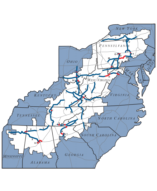
 This project was undertaken by the Appalachian Regional Commission (ARC), the Rahall Transportation Institute (RTI) and included all 13 Transportation Agencies within the Appalachian region. The main goal was to develop a comprehensive and integrate Geographic Information System (GIS) for the “The Appalachian Development Highway System 2012 Cost to Complete Estimate”. The ARC and RTI partnered to cost share on the creation of this multi-phased project to accomplish this task, with the ultimate goal to create the next Cost to Complete Estimate tool. It will be a web-based GIS application used by the state ADHS Coordinators to create the next Cost to Complete Estimate. The end result being to address the needs of all 13 ARC states to create, manage, and effectively utilize the Cost to Complete Estimates.